



Fuerteventura · Northwest coast · El Cotillo
Playa de la Concha in El Cotillo
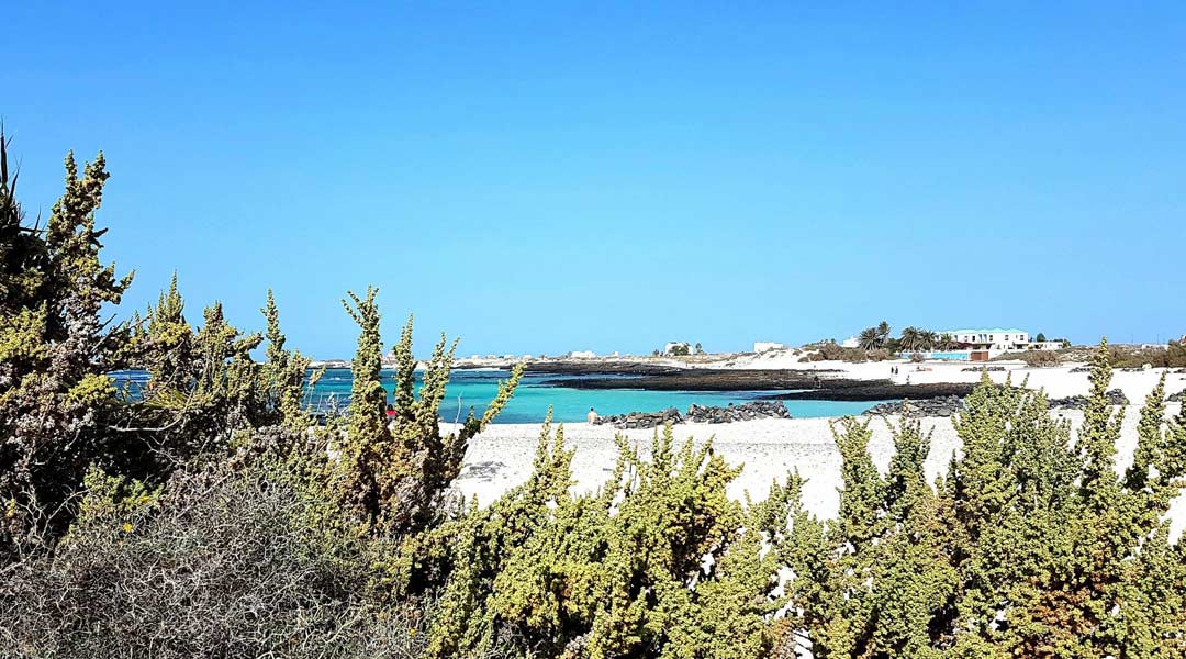
Just north of El Cotillo, pale sand curves around a bay sheltered by a natural reef. Here’s how to get to Playa de la Concha, choose a spot for a family beach day and walk along the lagoons.
Fuerteventura · Northwest coast
Where is Playa de la Concha?
The bay is north of El Cotillo, along the lagoons on the northwest coast.
Get directions in Google MapsIsland outline · ISTAC · Gobierno de Canarias, simplified.
Playa de la Concha at a glance
Beach compass

LocationNorth of El Cotillo
BeachPale sandy bay
AccessFrom the coast road
Check the flag before going in
The reef softens the swell. Look at the beach flag and the conditions on the day before you enter the water. Stay on shore when the red flag is flying.
Coast guide
The bay and lagoon at Playa de la Concha
Playa de la Concha sits at the northern edge of the lagoons at El Cotillo, in the municipality of La Oliva. The island’s official tourism guide puts the length of the bay at about 220 metres. Coming from the village towards the lighthouse, you’ll find it just beyond the coves of Los Lagos.
A sandy bay behind the reef
A horseshoe-shaped reef partly encloses the bay and reduces the force of incoming waves. From the beach you can see the colour of the water shift where the pale seabed meets darker rock.
Rock pools at low tide
As the tide drops, pools of seawater remain in hollows between the rocks. Look into them from the dry edge and leave shells and marine life where you find them.
Windbreaks made of lava stone
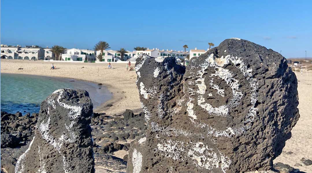
The low, circular stone walls are known locally as corralitos. Depending on the wind direction, they offer a little shelter and a place to pause.
Swimming bay · Tides
Swimming at Playa de la Concha
On calm days, the sandy part of the bay is a practical place to spend time with children. Go in with them and stay close enough to reach them immediately. Keep clear of the outer reef and watch for slippery rocks at the edges of the bay.
The flags reflect the conditions at the beach. Red means swimming is prohibited. Take particular care when the flag is yellow. A green flag means you can swim if the conditions suit your ability. If you’re unsure, check with the lifeguard or stay on shore.
At low tide you’ll see more of the rocky edge. As the water comes back in, the strip of dry sand can narrow. Set down towels and bags far enough back that there’s still room when the tide rises.
El Cotillo · Municipality of La Oliva
Getting to Playa de la Concha
The bay is north of the village centre. Search your map for “Playa de la Concha, El Cotillo” to avoid ending up at the beach of the same name on Isla de Lobos.
On foot from El Cotillo
Walk north from the centre towards Los Lagos and follow the coast to the bay. From the beach you can carry on towards the Faro del Tostón lighthouse.
By car
Take the coast road north from El Cotillo towards Faro del Tostón. There is parking near the beach. Follow the local signs and keep access routes clear.
Beach access
The entrance is close to the road and the last stretch leads onto sand. If you need a firm surface to reach the beach, check beforehand what assistance is available.
Planning a beach day
5 tips for your visit
A short walk from the old harbour
Start at the old harbour and head north through the village. The coves at Los Lagos are an easy place to pause along the way. Continue to Playa de la Concha until the wide curve of sand opens out in front of you. For a short outing, return the same way. That makes it easy to turn back early if the wind picks up.
With children, take a look at the entry point and the flag before putting your towels down. Pick a spot with a clear view of the part of the bay you’ll use. If conditions are poor for swimming, walk along the sand or take a break back in the village.
-
Check the wind forecast
The reef reduces the swell, but the beach can still be windy. Check the forecast if you plan to spend several hours here and pack a light layer if it looks breezy.
-
Work with the tide
Lower water exposes more of the rocky edge. If your plan is to sit and read by the water, leave a gap between your towel and the waterline.
-
Bring water and make shade
Pack drinking water, sun protection and a beach umbrella if you need one. The stone walls offer some wind shelter. For midday sun, bring your own shade.
-
Stop for a break in El Cotillo
There’s a restaurant near the beach. Pack a snack if you want to keep your plans flexible, or head into the village for a longer lunch break.
-
Continue to Faro del Tostón
If you have time after the beach, add the lighthouse. Our coastal walk through El Cotillo shows how to visit both on foot.
Beach gallery
Playa de la Concha in photos
See the curve of the sandy beach and the rocky edge of the lagoon.

Frequently asked questions about Playa de la Concha
Which Playa de la Concha is this?
This beach is north of El Cotillo in La Oliva, on Fuerteventura’s northwest coast. There is another beach of the same name on Isla de Lobos.
Is the bay suitable for a family beach day?
On calm days, the sandy entrance and shore make it a practical choice with children. Check the beach flag and stay within arm’s reach of young children when they’re in the water.
Are there lifeguards at Playa de la Concha?
The official tourism guide lists a lifeguard service. Check on arrival whether the station is staffed and follow the flags and any instructions from the lifeguards.
Can I park near the beach?
Yes. There is parking close to the bay, off the coastal road from El Cotillo towards Faro del Tostón.
What can you see at low tide?
More of the rocks and tide pools are visible around the lagoon’s edge. If you’re considering a swim, check the flag and the current conditions.
More of El Cotillo and Fuerteventura
Explore El Cotillo · Beaches in Fuerteventura · Playa de la Concha on Visit Fuerteventura