



Fuerteventura · North coast · La Oliva
Majanicho Beach on Fuerteventura
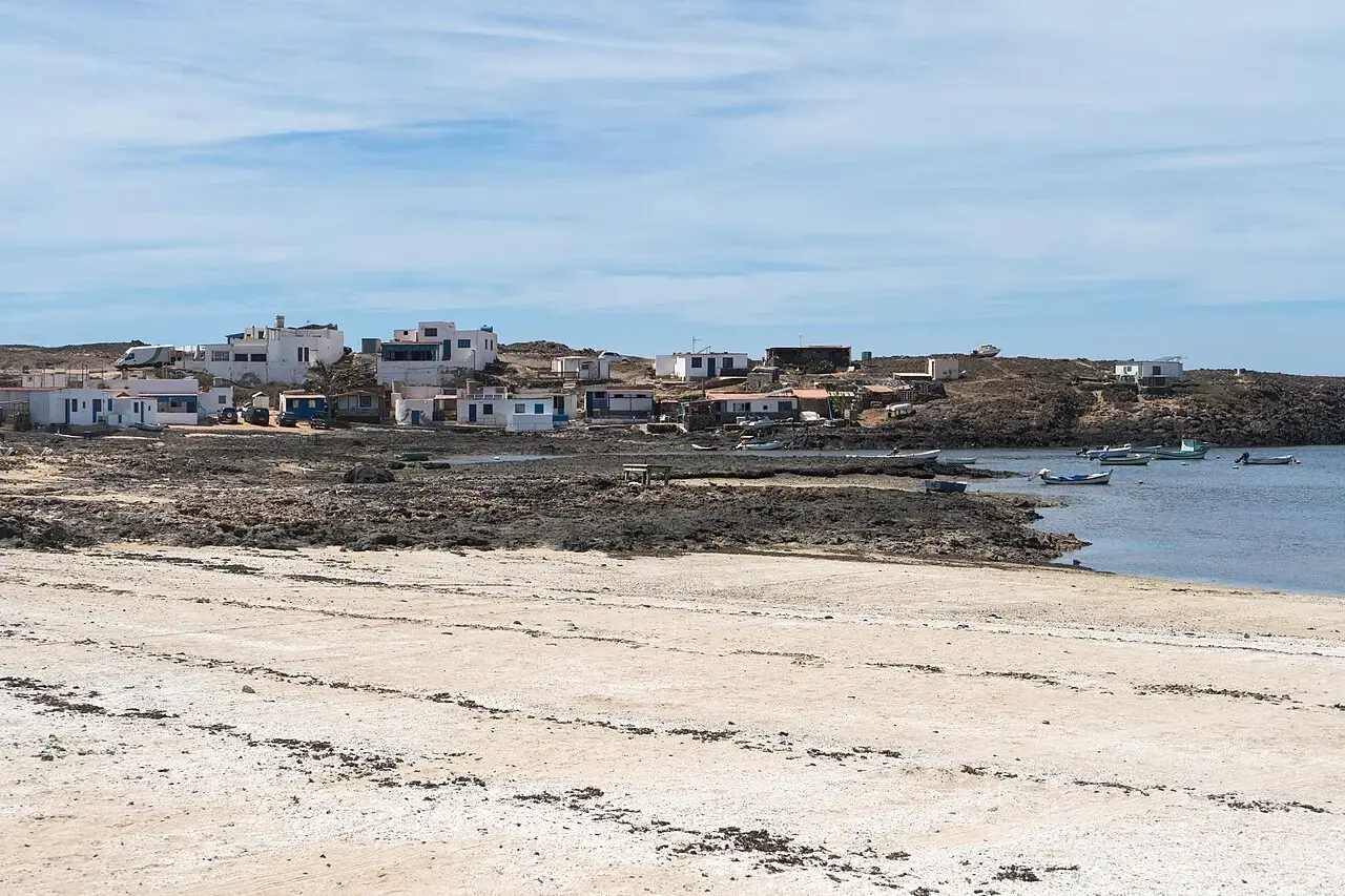
Whitewashed fishing cottages by the water, a small cove and the reef breaks of Fuerteventura’s North Shore.
Fuerteventura · North coast · La Oliva
Where is Majanicho Beach?
Majanicho Beach is on Fuerteventura’s north coast, between El Cotillo and Corralejo. The paved road from Lajares leads straight to the small settlement by the cove.
Get directions in Google MapsMajanicho Beach at a glance
Beach guide
The cove at Majanicho Beach
The houses in Majanicho sit close to the water. At low tide, pale strips of shore and dark rock shelves emerge around the cove. A short walk shows the contrast between the sheltered inlet and the open north coast.
Why visit Majanicho Beach?
For a first visit, start with the view from shore. Around the small cove you can see fishing cottages, boats and the dark lava shelves of the north coast close together. At lower tide the rocks stand out more clearly. At higher water the cove reaches closer to the houses, so the same stretch of coastline can look quite different.
For a short visit
Walk along the village and look out over the cove from a dry, stable spot. Keep clear of boats, private access points and rock shelves that the water reaches.
Swimming and tides
The tide changes the shoreline and the way into the water. Check how far the surf reaches into the cove on the day. For a day spent swimming, choose a lifeguarded beach with suitable conditions.
Rhodoliths on the shore
Rhodoliths also wash up at Majanicho Beach. The municipality of La Oliva asks visitors to leave these pale carbonate nodules on the beach.
Surfing at Majanicho Beach
The FreshSurf Spotfinder lists Inside Left, Inside Right and Outside. They are different peaks along the same stretch of coast. Whether one suits you depends on the swell, wind, tide and your experience. Look at the entry and exit from shore and check conditions with someone who knows the spot.
A cove visit and a surf check
If you are visiting Majanicho Beach for a walk or photos, start around the cove. For a surf check, look farther out as well. Compare several sets on the inside and outside reefs and see where other surfers return to shore. The waves inside the cove only show you part of the picture.

Inside Left
The inside left can start breaking when a large swell reaches the more exposed stretches of the North Shore. Watch the reef and check your route back to shore.
Inside Right
The inside right can be mellower in suitable conditions. The FreshSurf Spotfinder lists it for, among others, intermediate surfers and longboarders.
Outside
The outside right picks up north swell. The paddle is longer. Assess the outer reef separately and plan your return before entering the water.
Getting to Majanicho Beach
A paved road leads from Lajares to Majanicho Beach. Some sections of the coastal routes towards Corralejo and El Cotillo are unpaved. For a short visit, the route via Lajares is easier to plan.
Which route is best for Majanicho Beach?
If you want to go straight to the cove, drive via Lajares. The paved Camino de Majanicho passes the volcanic landscape around Calderón Hondo. The coastal track is a separate route. If you have a hire car, check in advance which roads your agreement covers.
By car
Set your destination to Majanicho, La Oliva, and follow the local signs. Keep driveways and access to the water clear.
On foot along the shore
Use existing paths and keep back from the water in heavier surf. Bring water and sun protection for a longer walk in heat or wind.
5 practical tips for your visit
Start in Lajares
The paved approach is handy for a visit to the cove or if you want to avoid unpaved roads.
Check conditions from land first
The outer peaks and the shallower cove respond differently to swell and tide. Watch several waves before choosing where to get in.
Keep the village road clear
Park only where allowed and leave room for residents and boat access.
Leave rhodoliths on the beach
If you find white nodules, photograph them where they lie. They are part of the shoreline.
Pack water and suitable shoes
Shoes with a good grip help on rocky paths. Bring drinking water and sun protection if you plan to stay longer.
Majanicho Beach in pictures


Frequently asked questions about Majanicho
Where is Majanicho Beach?
On Fuerteventura’s north coast in La Oliva, between El Cotillo and Corralejo. A paved road from Lajares reaches the cove.
Can you surf at Majanicho Beach?
Yes, in suitable conditions. FreshSurf distinguishes Inside Left, Inside Right and Outside. Check the forecast, reef, currents, entry and exit at the spot.
Is Majanicho Beach suitable for beginners?
The peaks break along a reef coast. If you have little experience, ask a local surf school to assess the conditions and help you choose a spot that suits you.
Do I need a 4×4 to reach Majanicho?
You generally won’t need a 4×4 on the paved road via Lajares. If you’re considering the coastal track, check its condition, access and the terms of your car hire.
Does Majanicho have popcorn-like rhodoliths?
White rhodoliths also occur along this coast. The map pin on this page marks the cove at Majanicho. Playa del Bajo de la Burra is farther east, towards Corralejo.
Popcorn Beach or Majanicho Beach?
The houses around the cove are a good landmark for Majanicho. If you specifically want to see the white rhodoliths at Playa del Bajo de la Burra, the Popcorn Beach guide shows that separate stretch of coastline and how to get there from Corralejo.
Photos · Alexey Komarov, Majanicho 2023-09-06 and Josi, El Majanicho · CC BY-SA 4.0 · WebP versions, cropped to fit where needed, under the same licence.
Surf image in the gallery · AI illustration.