



Fuerteventura · Southeast Coast · Pájara
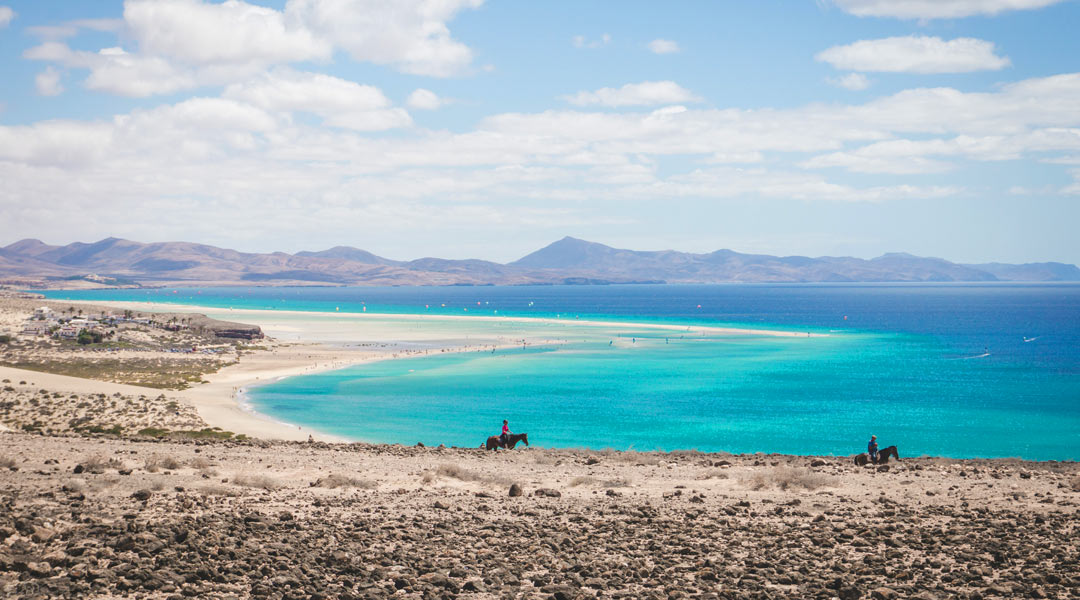
Playa de Sotavento, Fuerteventura
Sandbanks, a tidal lagoon and a long stretch of open coast.
Fuerteventura · Southeast Coast · Pájara
Where is Playa de Sotavento?
Playa de Sotavento is on the Jandía peninsula, south of Costa Calma. La Barca and Risco del Paso are separate access points along the same coast.
Island outline · ISTAC · Gobierno de Canarias, simplified.
Sotavento at a glance
Beach compass
Playa de Sotavento and its tidal lagoon
Sotavento covers about nine kilometres of pale sand on Fuerteventura’s southeast coast. The tourism board lists five sections, including La Barca, Risco del Paso and Malnombre. The familiar lagoon sits between the shore and a sandbank. At low water you can see more of the exposed sand. Shallow pools form when enough seawater reaches the landward side of the bank.
La Barca
The more northerly access point is near Costa Calma. It’s a useful starting point for the lagoon and the water-sports centre. Check the local tide table before setting off if you want to photograph the sandbank and water.
Risco del Paso
Further south, a broad stretch of sand opens out below the slopes of Jandía. It’s a good place to start a walk along the coast. The shape of the shore changes with the tide here too.
When does the lagoon fill?
Both the height and timing of the tide matter. A high tide doesn’t guarantee a full lagoon. Check the local timetable for the day you plan to visit.
Windsurfing and kitesurfing at Playa de Sotavento
Sotavento is a well-known windsurfing and kitesurfing spot. The wind can be strong and gusty, and the lagoon and open sea call for different skills. Ask a local school or centre which area suits your experience that day and what rescue support is available.
Lagoon and open water
Depending on the tide, the lagoon is shallower than the open sea. Follow local signs and instructions for launching, landing and practice areas. If you’re walking along the beach, give riders room to launch and land their kites.
Wave surfing at Risco del Paso
Risco del Paso is mainly known for wind sports. The local spot guide describes predominantly wind waves. If you’re looking for conventional surf, check the forecast at a recognised wave-surfing spot.
Getting to Playa de Sotavento
Take the FV-2 south from Costa Calma. Decide which section you want to visit before setting off. The two route links lead to separate parking areas. You’ll cross sand to reach the shore. Leave a little extra time for the walk back in strong wind or heat.
Driving to La Barca
Set your destination to La Barca in Pájara. From here you can see where the sandbank lies and check the marked zones around the lagoon.
Driving to Risco del Paso
Use the route to the Risco del Paso car park. Check the condition of the approach on arrival and stick to marked parking spaces.
Getting there by bus
Check route 01 with TIADHE. The operator lists the Gorriones stop as suspended until further notice. Use the current stop list to plan both legs of your journey. Check the current timetable and stops.
5 tips for your visit
Check the tide before leaving
If you’d like to see water in the lagoon, use the local lagoon timetable. Its shape and size can change within the same day.
Check wind and sea conditions
Pack an extra layer for the wind. If the conditions at the water’s edge look uncertain, stay on dry sand.
Choose your starting point
Start at La Barca for the lagoon and water sports. Pick Risco del Paso to explore the southern stretch on foot.
Give water-sports areas room
Follow the signs and avoid crossing areas where kites are being set up, launched or landed.
Plan the walk back
Stick to dry sand with a clear way back. Bring water, sun protection and something to shelter you from the wind during a break.
Choose your access before setting off for Playa de Sotavento. Use La Barca if you want to see the tidal lagoon or the wind sports area, and use Risco del Paso if your plans centre on the southern stretch. The pin for Playa de Sotavento covers a long coastline, so the two entrances can look closer on a map than they feel on foot.
For a walk at Playa de Sotavento, check the water channels on the way out and leave enough time to return before the tide changes the route. If seeing the lagoon is your priority, keep your timing flexible and use the local timetable as a starting point.
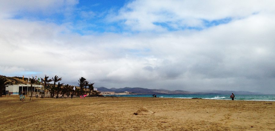
Sotavento in pictures
Frequently asked questions about Playa de Sotavento
Where is Sotavento in Fuerteventura?
It’s on the southeast coast of the Jandía peninsula, south of Costa Calma in the municipality of Pájara. La Barca and Risco del Paso are two ways to reach this stretch.
When is the Sotavento lagoon full?
It fills on suitable tides. Check the local lagoon timetable for the date of your visit. Water levels vary from day to day.
Can you swim at Playa de Sotavento?
It depends on the section, wind, waves and water level. Follow beach flags and keep clear of marked water-sports zones. Stay out of the water when the red flag is flying.
Can you surf at Sotavento?
The coast is best known for windsurfing and kitesurfing. Risco del Paso can get wind waves. If you’re going wave surfing, check conditions and choose a spot suited to your ability.
Which access point is best for a short visit?
La Barca is closer to Costa Calma and is a useful starting point for the lagoon. Risco del Paso is a good choice if you want to see the southern stretch.